
Lancaster Previous Residents by Era
A backward address trail changes sources as it crosses record eras. Erie County deeds provide the ownership backbone, but their online index and image windows are not the same. Lancaster assessment and permit portals supply current and dated property clues without a stated historic start date. Regional directories, census releases, newspapers, vital indexes, and Sanborn maps provide household or building context. The table identifies each documented boundary rather than promising that every Lancaster address is searchable online.
| Source | Years It Covers | Where Held | What It Shows |
|---|---|---|---|
| Erie deeds | Maintained 1808-present; index 1986-present; images 1960-present | Erie County Clerk | Grantor, grantee, recording date, legal description, book/page or instrument |
| Lancaster assessment | Current interactive record; historic run not stated | Town of Lancaster PROS | Owner, situs and mailing address, assessment, inventory, sales |
| Lancaster permits | Archive start not stated | Town BAS or code office | Permit holder and construction, demolition, occupancy, or compliance evidence |
| Regional directories | Grosvenor Buffalo 1828-present; digital Buffalo 1832-1913 | B&ECPL and New York Heritage | Printed occupant or head-of-household, address, and occupation lead |
| Federal census | 1790-1950 released | NARA and library databases | Household composition and enumeration geography |
| Sanborn maps | New York coverage 1867-1970; check locality availability | B&ECPL database | Building footprint, use, and street context |
Start with the source closest to the date needed. A current parcel supports the first deed search. A mid-century address may need the Graves index and deed books. A household question between census years may be better served by a directory or newspaper.
Start Lancaster Past Residents With an SBL
For past residents, the current parcel is a starting reference, not the answer. Search the address in PROS and preserve the situs, owner style, mailing address, SBL, subdivision or lot clues, assessment date, and any deed reference. The property record distinguishes the physical address from where a tax notice goes. That distinction becomes essential when an older deed names a trust, estate, corporation, or owner who did not receive mail at the property.
The Lancaster permit parcel search shows address, owner or business, SBL, and location routes that can connect a property to dated Town records.
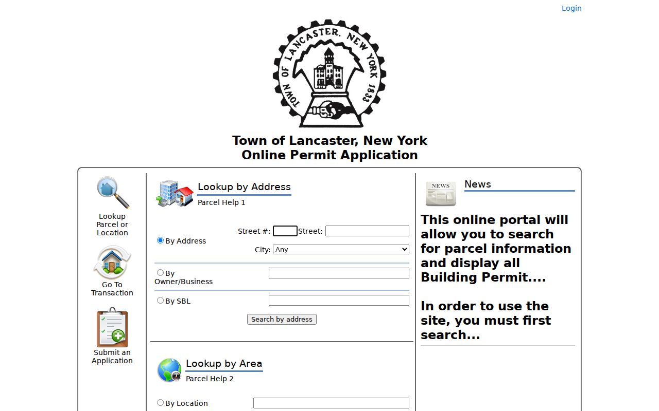
Permit results can date a project or identify an applicant or holder, but neither role establishes every past resident. Keep permit number, date, status, parcel, project description, and source date as separate fields.
Follow Lancaster Previous Residents Through Deeds
The Erie County Clerk is the ownership trail's custodian. The Clerk does not search deeds by street address, so enter with the owner name, SBL, deed book and page, or instrument found from the parcel. A grantor transfers a property interest. A grantee receives it. Once the current purchase is found, the seller commonly becomes the earlier acquisition search, but the legal description and parcel identifiers must confirm each connection.
- Copy the current parcel's owner style, SBL, situs, subdivision or lot data, and deed book, page, or instrument reference.
- Search the current grantee or owner in the recorded-deed index. Narrow by deed type, town, and date where the record permits.
- Record the grantor, grantee, recording date, consideration when shown, legal description, and book, page, or instrument number.
- Search that grantor as a grantee to find an earlier acquisition. Compare SBL, block, lot, spouse, trust, entity style, and land description.
- When the index stops, use Graves, liber or book-and-page searching, a Clerk public terminal, a focused request, or deed books and microfilm.
The Erie County Official Records Public Search is the Clerk's main entry point for basic, advanced, registered, and browser routes.
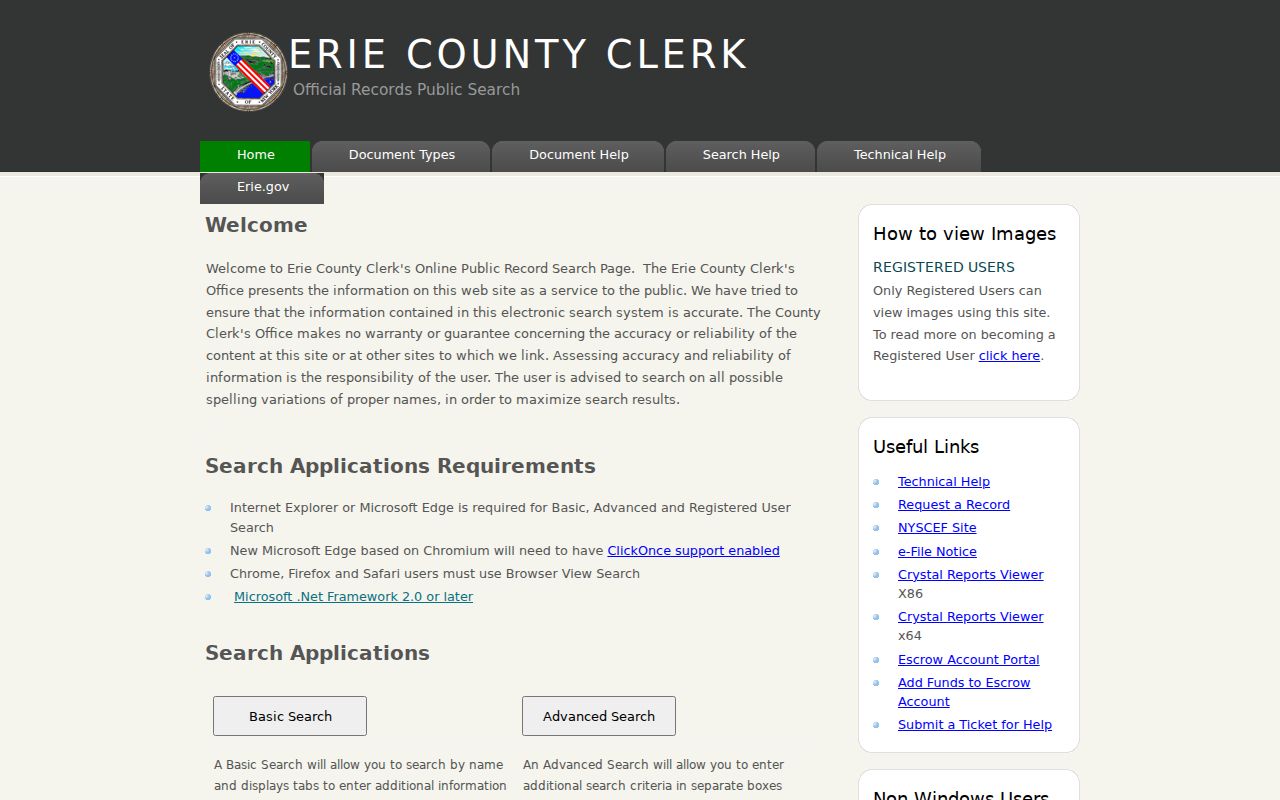
The free remote result is an index route. Registered users can view and print images, while a public workstation at the Clerk's office offers another image-access channel. Certified copies follow the request and copy process.
Lancaster Deed Windows and Graves Index
Erie deed records are maintained from 1808, but remote access changes by era. The online land index begins in 1986. Deed images begin in 1960. For 1960 through 1985, the documented bridge is the Graves alphabetic grantor and grantee index with liber or book-and-page searching. Before 1960, use Clerk books, staff-assisted research, public terminals, microfilm, or a request. Continued deed-liber scanning is a preservation priority, not a promise that every older book is already searchable remotely.
The Erie County Clerk BrowserView exposes party, document type, instrument, book/page, map number, parcel ID, town, and date controls for the deed trail.
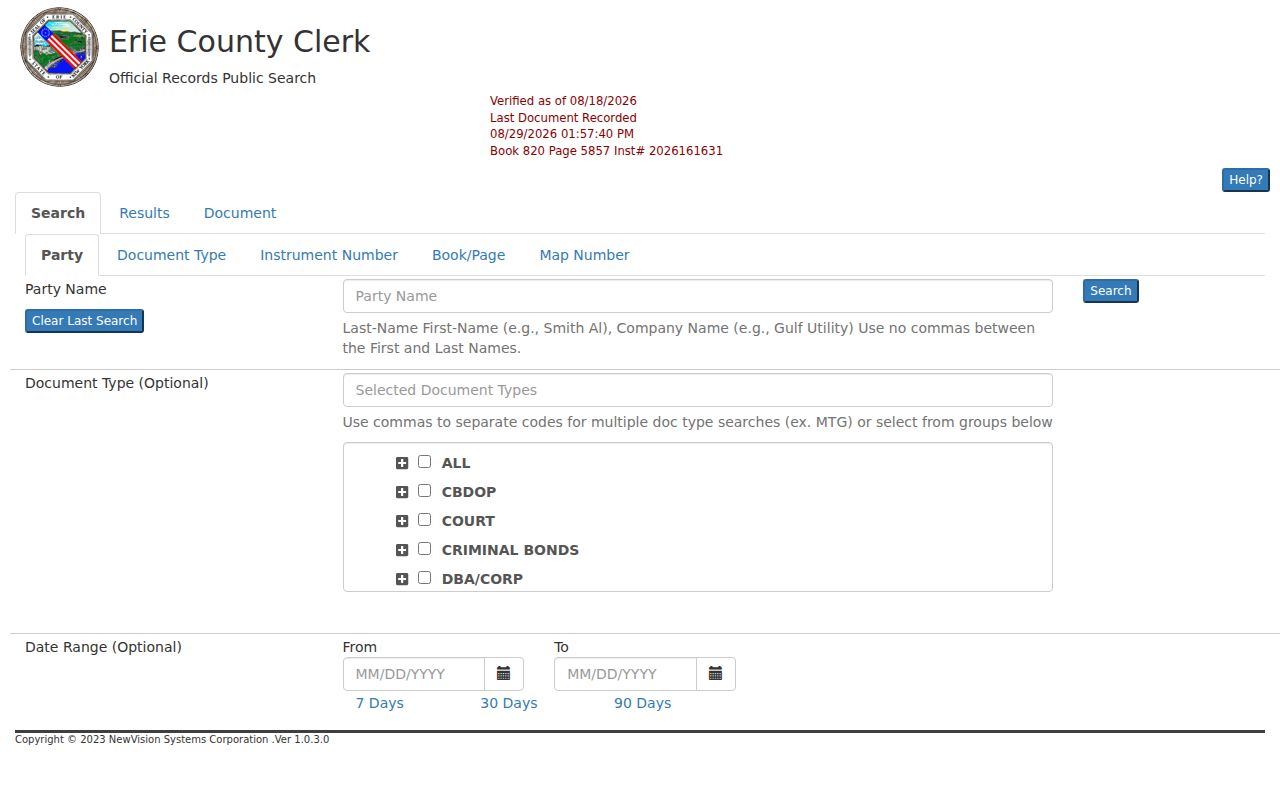
BrowserView reports verified-document status and last-recorded information. Record an access gap honestly: an index hit, an image, a book reference, and a certified copy are different levels of evidence.
Note: The Clerk lists manual searching at $10 per name per two-year period and digital searching at $5 per name per two-year period when staff research is needed.
Pair Lancaster Directories With Census Years
Ownership is only one side of previous residents research. Directories provide a printed address-and-name snapshot; the federal census provides a household and enumeration snapshot. Match a directory year with the nearest released census year while allowing for publication date, census day, move timing, and the directory's territory. A person can be omitted because the volume covered a city or trade area, used a different locality label, or printed an initial, spouse name, widow notation, or business instead.
- Find the address or household in the latest suitable directory and transcribe its name style, street form, locality, occupation, and abbreviations exactly.
- Move back one directory year at a time, marking first and last appearance rather than assuming a gap means a disappearance.
- Pair each material directory clue with the nearest released census and compare household composition, enumeration district, street, and age data.
- Resolve a likely move with a deed, newspaper, obituary, cemetery entry, or probate file and retain the source date and uncertainty.
Federal census releases run through 1950 as of this research date. Census geography and directory territories do not equal modern parcel boundaries, so the SBL and legal description remain the stronger land crosswalk.
Lancaster Previous Residents in Directories
The Buffalo & Erie County Public Library's Grosvenor Room holds Buffalo city directories from 1828 to the present and directories for other locations. The free digital Buffalo collection at New York Heritage spans 1832 through 1913 in 77 original-date items. A 1872 digital item includes Lancaster in its metadata, which supports regional searching but does not prove a complete Lancaster household roll. Lancaster Public Library adds non-circulating Lancaster and Depew local-history materials, yearbooks, and regional-history resources.
The New York Heritage Buffalo directory collection is the digitized regional subset shown below.
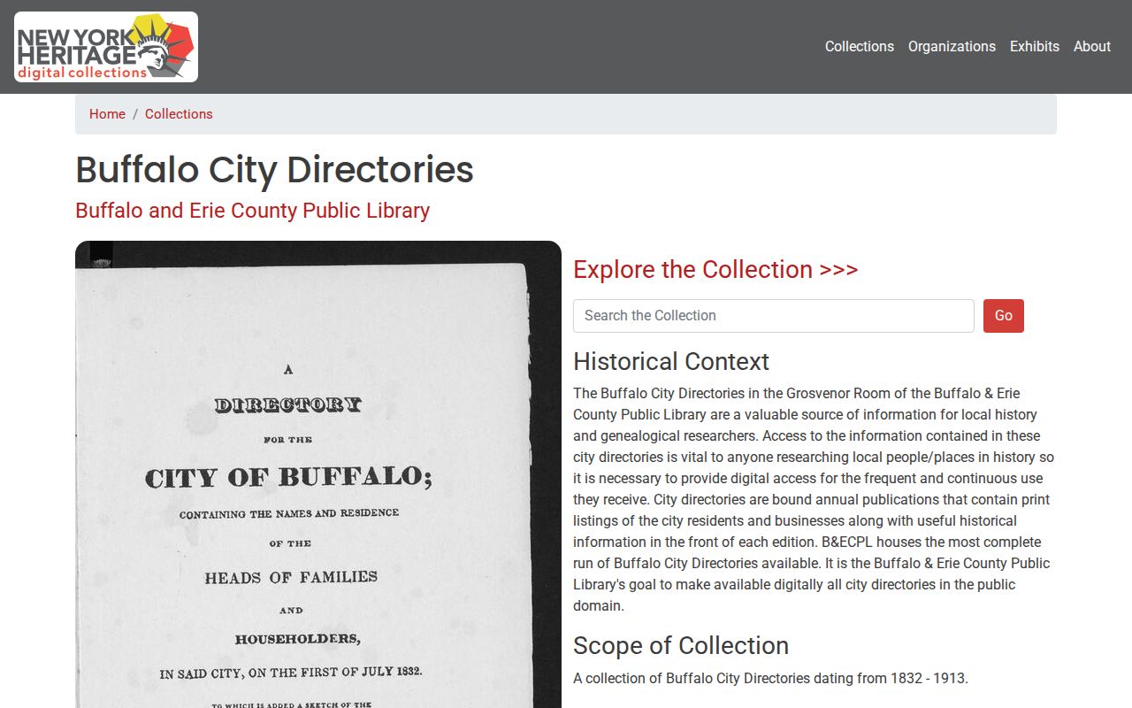
Use the digital collection for a free first pass, then ask Grosvenor or the Lancaster branch about the printed shelf, local-history groups, database access, and reproduction rules. The Lancaster city directories collection covers those sources in more detail.
Date a Lancaster Building Carefully
Sanborn maps and permit files help establish when a building form, use, addition, demolition, or street arrangement existed. They do not list every resident. B&ECPL's Sanborn Maps of New York database spans 1867 through 1970 and includes more than 50 Erie County locations, but the availability of a particular Lancaster sheet and year must be checked. A permit or certificate may name an applicant or holder and date work while still saying nothing definite about a household.
Use building evidence as a time marker beside deeds and directories. Save the map sheet, permit number, status, parcel, and date. Utility customer records are not a public address-history fallback.
Lancaster Past Residents Trail Endpoints
An obituary, funeral notice, cemetery record, or probate case can help close a dated household trail. B&ECPL resources include newspapers and obituary assistance, and Erie County Surrogate's Court holds estate material. An obituary can point to family relationships, a former address, or a service location. Probate can identify an executor, heir, attorney, or legal representative. Both are leads that need comparison with a vital index, court file, or other primary record when precision matters.
WebSurrogate offers name, file, old-index, index-book-page, and will searches for estate research. Earlier unrestricted documents may require public computers at the court, and restricted information is not an address-history source. When remote access fails, use the custodian's request channel with the known name, date range, and file information.
Lancaster Address Labels Need Checks
Previous residents research has a geographic trap: the Town, Village, Depew, and postal layers overlap. The 2026 local plan describes Walden Avenue as a Village and Town boundary and Transit Road as a municipal dividing corridor. A directory, permit, or election record can therefore look as if an address changed places when the underlying area is nearby. Link records with old and new street spelling, nearest cross street, SBL, plat or legal description, map sheet, postal place, and printed municipality.
No official Lancaster street-renaming or renumbering history was located. Do not invent a conversion year. When an older number does not fit, check historical maps, the Clerk's land description, library collections, and the relevant Town or Village office.
Lancaster Previous Residents Record Terms
These terms make the backward deed-and-directory process easier to audit. Record each term as it appears in the source, especially where a property has been subdivided or held through an estate, trust, or entity.
- Grantor
- The party transferring a property interest in a recorded document.
- Grantee
- The party receiving that interest. In a backward chain, a seller is often found as a grantee on an earlier acquisition.
- Chain of title
- The sequence of recorded transfers and related documents tracing ownership of the same land.
- Legal description
- Lot, block, subdivision, or metes-and-bounds language that identifies land more durably than a street address.
- Criss-cross directory
- An address-arranged directory that can identify the name printed for an address in one edition.
Past residents and past owners should remain separate columns in a research log. A deed shows a land-interest relationship; a directory or census may add a dated household relationship at the address.
Lancaster Past Residents Privacy Boundaries
Historical research should respect current privacy limits. Protected voter files, the New York Address Confidentiality Program, sealed court or adoption material, restricted vital records, and DMV protections can limit availability. A missing name may reflect a protected record, a collection gap, a spelling variation, or a different custodian. Keep only the identifiers needed to distinguish records and direct an error correction request to the office that created the record.
Lawful use. Use Lancaster house-history and family-history records for personal, historical, estate, or civic research. Never use a past address, name, or record detail to stalk, threaten, harass, or harm a living person.
New York's Freedom of Information Law can request existing non-exempt agency records, but it does not require an office to create a new historical list or disclose protected information. When an online search fails, use a focused custodian, library, archive, or court request with the known name, date range, and land identifier.