
Trace a Lancaster Street by Address
Use a short record trail for each Lancaster address. The Town assessment record supplies the property-side starting point. Erie County mapping then places the parcel beside nearby parcels and identifies the geographic context. The Clerk follows people and document identifiers rather than street lines, so the parcel result is the bridge into the deed index. A known voter may use the state form for personal registration confirmation, while historic directory volumes add an older printed address clue. Each source answers a different question.
- Normalize the number, directional, street suffix, unit if any, postal city, ZIP, and municipality. Keep the physical location separate from a tax mailing line.
- Search Town of Lancaster PROS. Save the owner style, situs and mailing address, SBL or parcel identifier, assessment date, and any deed reference shown.
- Open Erie County On-Map with parcel and road layers. Identify the target parcel, note adjoining SBLs, and retain the town or village fields.
- Search the Erie County Clerk by the current owner or grantee name and deed type. Compare the legal description, grantor, date, and document identifier before adding it to the trail.
- Check Town permit records by address, owner or business, SBL, or location. For an older occupant question, consult directories, census material, newspapers, and maps as dated sources.
That order matters because an owner, tax-notice recipient, permit applicant, and person printed in a historical directory can be different people. It also keeps the Town, Village, Depew, and postal layers from being collapsed into a single label.
Lancaster Street Directory Parcel Fields
The Town of Lancaster Property Record Online System, known as PROS, is the current property starting point for a street directory search. Its public description covers assessment information, property inventory, and comparable sales for town parcels. The live controls are interactive, so the research does not claim a fixed field order for every PROS screen. The related permit route does expose its address and parcel paths. Preserve every result with its retrieval date, especially during reassessment and exemption cycles.
| Field or route | Input type | Street-search use | Local note |
|---|---|---|---|
| Street # | Text or number | Starts a BAS permit address query | Use with street |
| Street | Text or select | Finds a named road | Exact control is dynamic |
| City | Dropdown | Separates municipal context | Optional or route-specific |
| Owner or Business | Text | Alternative property or permit route | Not proof of occupancy |
| SBL | Text | Crosswalk to parcel, permit, and deed work | Use displayed format |
| By Location or Area | Map/location control | Browses permit context | Search first for details |
The Town of Lancaster PROS property portal is shown below. Its detail is useful for separating a situs address from a mailing address before an Erie Clerk search begins.
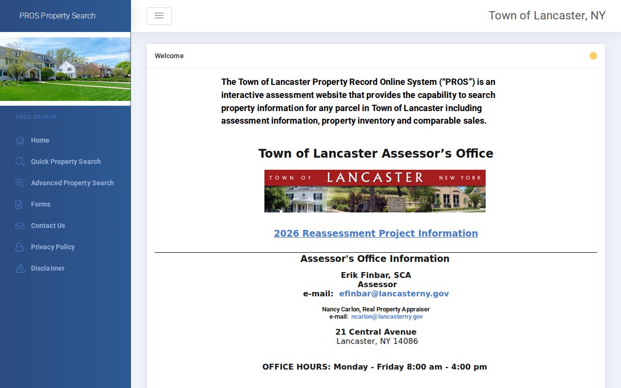
PROS is a property and assessment source, not a list of all people at a Lancaster address. A corporate, estate, trust, or out-of-town owner may be attached to a Lancaster situs.
Read Lancaster Streets in On-Map
Erie County On-Map makes street-by-street work visual. Its public layers include parcels, streets and highways, ZIPCODES, school and legislative districts, water features, wetlands, floodplain layers, agricultural districts, and soils. Parcel data on the cited mapping page is current to 2025, but update frequency is not guaranteed. Search or pan to the segment, identify the target polygon, and copy the parcel number, road name, town, and village fields before opening adjoining parcels one at a time.
The Erie County On-Map viewer provides the parcel layer shown here. It is a viewing and query tool, not a legal survey and not a substitute for a recorded land description.
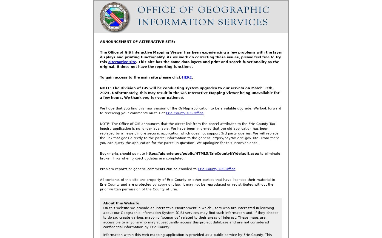
For a long Lancaster road, record the parcel and municipality fields for each segment rather than relying on one screen. Walden Avenue and Transit Road are boundary corridors, so a postal place alone can misstate the local layer.
Note: On-Map geometry and coordinates are generalized mapping data, so a recorded deed, plat, or survey controls a legal boundary question.
Turn a Lancaster SBL Into a Deed
Erie County's land-record system does not provide a street-address deed search. That is the central Lancaster street directory limitation. Carry the SBL, parcel details, deed book and page, or current owner name from the property record to the Clerk. BrowserView can search Party, Document Type, Instrument Number, Book/Page, Map Number, Parcel ID, and optional Town or date fields. Confirm a hit through its legal description and document identifiers, not a name alone.
The Erie County Clerk BrowserView index shows the party, document, parcel, map, and date routes used for that next step.
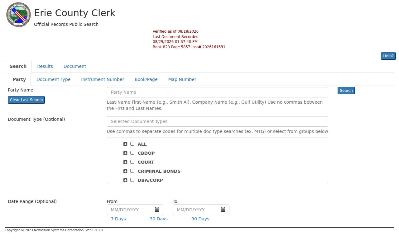
BrowserView displays verified-record status and last-recorded information. The free index gives record detail; image access follows the registered-user or Clerk public-workstation route.
Lancaster Street Records by Source
Address-keyed sources overlap, but they do not say the same thing. The table separates property facts from historical document, permit, voter, and directory evidence. It also identifies an access channel when a portal is incomplete. A careful street directory notes the office that produced each item and does not turn an owner, voter, or permit holder into an unsupported household claim.
| Record set | Keeper | What it can show | Access route |
|---|---|---|---|
| Assessment and parcel record | Town assessor | Owner style, situs and mailing lines, assessment, inventory, exemptions | PROS and assessor review |
| Parcel map | Erie County GIS | Parcel number, road, town or village fields, and adjacent parcels | On-Map viewer |
| Recorded deeds and liens | Erie County Clerk | Parties, dates, legal description, book/page or instrument | Free index, images, terminal, request |
| Permits and code items | Town BAS or code office | Permit holder, work, status, and dated project evidence | Address, owner, SBL, or location |
| Voter registration | NYS and Erie elections offices | Personal registration or election records under statutory limits | Personal lookup or lawful request |
| Regional directories | B&ECPL and Lancaster Library | Dated printed address or household lead | Digital subset, shelf, research help |
Deeds are maintained from 1808, while the online land index begins in 1986 and deed images begin in 1960. Older material has a different route. Do not call an online result a complete ownership chain until earlier books or indexes are checked.
Use Lancaster Permits as Date Clues
Town permit records add property history to a Lancaster street directory, not a full resident list. The BAS search accepts street number and street, city, owner or business, SBL, and location or area routes. After a search, permit information may identify a permit number, issue date, validity, parcel, applicant or holder, project description, status, and linked documents when available. Construction, demolition, certificates of occupancy or compliance, operating permits, inspections, and complaints can date work at a parcel.
The Lancaster permit parcel search displays the address, owner or business, SBL, and location paths before permit information appears.
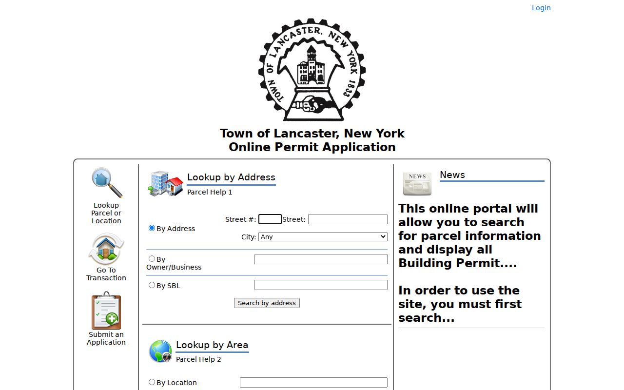
A permit holder may be an owner, contractor, agent, or another applicant. Keep that role in the notes rather than using a permit as proof of who lived at the address.
Lancaster Street Directory Clerk Access
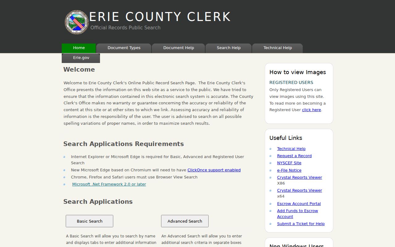
The Clerk's public record search offers basic, advanced, registered, and browser modes, but the street directory workflow still begins outside that system. Remote index searching is free. Registered users can view, save, and print images, while a public workstation at the Clerk's office provides an in-person image route. If an index number or book and page is missing, the request process can search, and the general rules explain mail requests and copy handling.
The Erie County Official Records Public Search is the Clerk's main entry screen for these modes.
Manual research is listed at $10 per name per two-year period and digital research at $5 per name per two-year period. Certified documents cannot be emailed, and the Clerk's request page says staff contacts a requester within two business days.
For deeds from 1960 through 1985, use the liber or book-and-page route and the Graves grantor/grantee index. Earlier records may require public-terminal, staff, book, microfilm, or written-request research.
Lancaster Street Directory Alert Checks
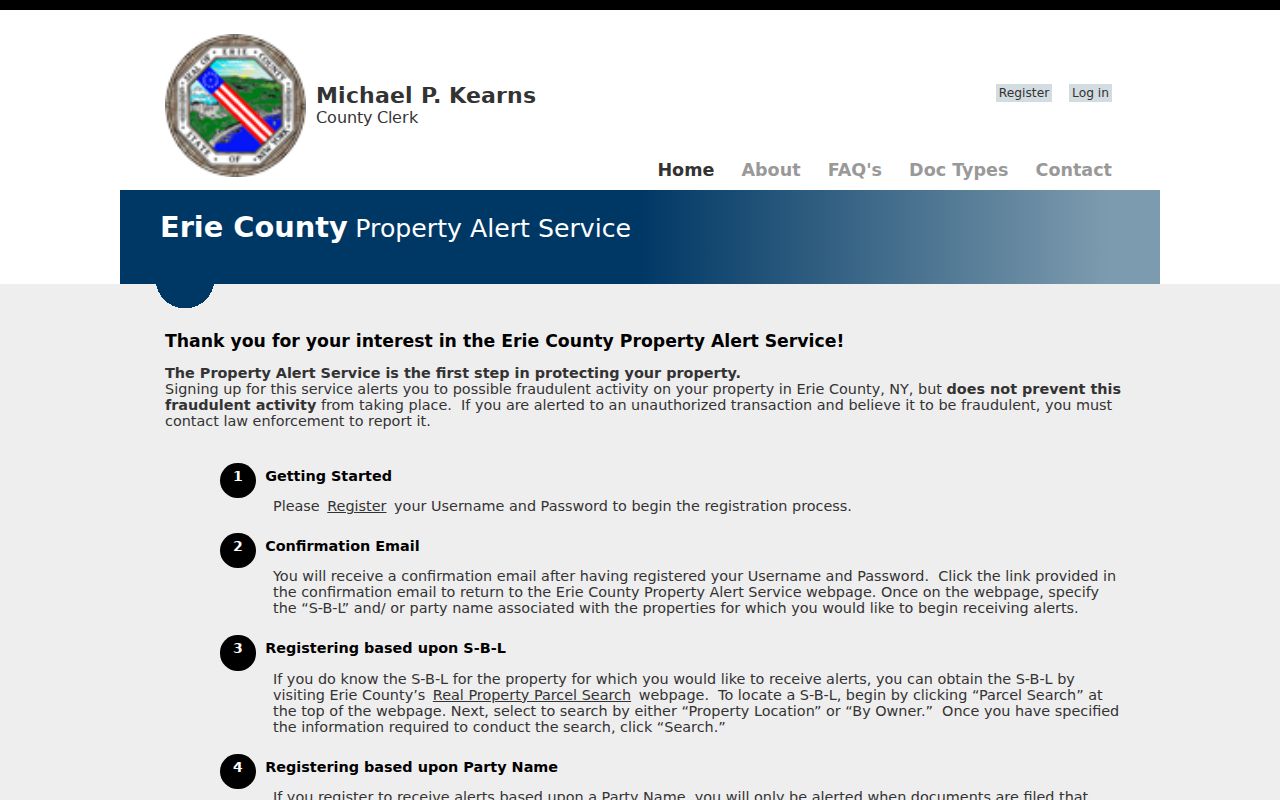
Property Alert is a separate Erie County tool for watching recorded-document activity tied to an exact S-B-L or exact party name. It is useful after a parcel record has been normalized because matching is exact. Register the parcel identifier and each name style that matters, including a middle initial or suffix. A filing that lacks both the exact S-B-L and exact party name will not produce an alert, so the service is not a title search or a fraud-prevention guarantee.
The Erie County Property Alert service explains the free registration and exact-match conditions shown below.
An alert should prompt document confirmation. When a filing looks suspicious, obtain the certified Clerk copy and contact the appropriate public-safety or records office rather than relying on the alert alone.
Lancaster Street Directory Boundary Clues
Lancaster's record geography is layered. The Town of Lancaster, Village of Lancaster, Village of Depew, and nearby postal labels can all matter to an address. The 2026 Lancaster-Depew plan identifies Broadway as a major east-west route and names Transit, Harris Hill or Central, Aurora, and Bowen as north-south corridors. It describes Walden Avenue and Transit Road as dividing corridors. A street result should retain the parcel's municipality, not simply its mailing city.
Neither an address search nor a ZIP result establishes every jurisdictional fact. On-Map's town and village attributes, permit authority, and the legal description are better checks than an assumed boundary line.
Note: No official Lancaster street-renaming or renumbering year was located, so older address changes require map, parcel, and directory crosschecks instead of a guessed conversion.
Earlier Lancaster Street Directory Leads
For a past address, reverse or criss-cross directories reverse the normal search direction: address first, then the printed occupant. The Buffalo & Erie County Public Library's Grosvenor Room holds Buffalo city directories from 1828 to the present and related directories for other locations. Its digitized Buffalo set covers 1832 through 1913, but a regional volume can include Lancaster references without being a complete townwide roll. Search the street, locality variants, surname variants, and printed jurisdiction.
The historical volumes and access routes are detailed in the Lancaster city directories collection. Pair a printed entry with a census, obituary, deed, or map before treating it as more than a dated lead.
Lancaster Street Record Terms
Several short terms keep the address trail readable. They are useful where a street line, tax mailing line, and recorded land description do not match exactly.
- Parcel
- A mapped unit of land used for assessment and tax administration. Its number or PIN helps join map and property records.
- Situs address
- The physical location of the parcel or building, distinct from the address where tax notices are mailed.
- Plat
- A recorded map that can show a subdivision, lots, blocks, and related land references.
- Criss-cross directory
- An address-arranged directory that can identify the name printed for that address in that edition.
Use the legal description, SBL, map number, book and page, subdivision, and lot or block fields as the crosswalk when an older Lancaster street form is uncertain. A street address alone is the least durable identifier in the chain.
Privacy Limits for Lancaster Streets
A Lancaster street directory can document public property and recorded-document access, but it cannot turn a tax roll into a household list. Non-owner occupants, guests, unregistered people, utility customers, and protected addresses are not generally public street-search results. The NYS voter lookup is a personal registration and poll-site form, not a streetwide browse tool. Voter-file requests have election-purpose limits under Election Law §3-103(5), and qualifying confidential voter records are held apart under Election Law §5-508.
Lawful use. Use Lancaster address records for personal, historical, property, family, or civic research. Do not use names, addresses, or record details to stalk, threaten, harass, or harm anyone; report a suspected error to the office that holds the record.
New York's Address Confidentiality Program can supply a protected substitute address for eligible participants, and DMV personal information is separately limited by federal law. A missing result may reflect privacy protection, a name variation, a record gap, or a different municipal custodian.